
We stayed up late the night before, so we did not hit the road until nearly 10 AM. Lori made delicious scrambled eggs with chopped up bits of leftover steak from the night before, so we had plenty of fuel for the (unbeknown to us at the time) long trek ahead.
I had plugged the directions from Google Maps into my Droid phone, as they had looked the most accurate to me the night before. Things went very well until we got to Olema, CA (10 minutes out from our rental home) and the directions told us to turn on to Sir Francis Drake Blvd. I knew from the night before that the route was supposed to stay on Highway 1 all the way down. I ignored the turn, trusting that the navigation would re-route us correctly. More on that later.
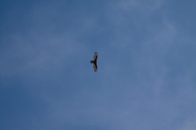 One of many raptors soaring along the coast
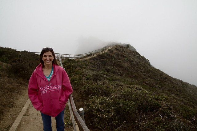 Lori poses at Muir Beach Overlook
The drive south out of Point Reyes Station was very scenic, and the roads were twisty and fun to drive. It reminded me a lot of the drive we took up the Pacific Coast Highway from LA to Monterey on our honeymoon. Unfortunately, there was a heavy fog rolling in from the ocean, so we did not get to see much of the actual ocean itself along the way.
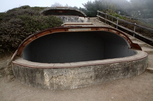 Muir Beach Base End Station
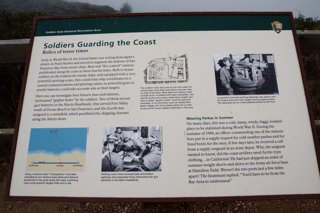 A sign explaining the purpose of the Base End Stations.
We were fine following the directions right up until we passed the sign for Muir Woods National Monument. We both saw the sign, but trusted the navigation which told us to keep going. I thought there might be a different way in to the park, so we kept going. And we kept going all the way to Sausalito, where the navigation told us our “destination” was the intersection of Turney and Bonita Streets. FAIL.
So then I punched up the directions which were generated by using the GPS co-ordinates given on the official Muir Woods National Monument Web site. Those couldn’t be wrong, could they? Well, we ended up back in Mill Valley, but the nav lead us deeper into a twisty maze of very narrow residential streets until we ended up at our “destination” — someones driveway!
After many “words’ exchanged between us and several miles of twisty, narrow residential roads traversed, we finally emerged back in what appeared to be the down town area of Mill Valley. I stopped a couple of times to get my bearings and compare those to the map (minus any help from the nav). I was then able to plot a route back to where we saw that Muir Woods sign a few hours previous and struck off in that direction.
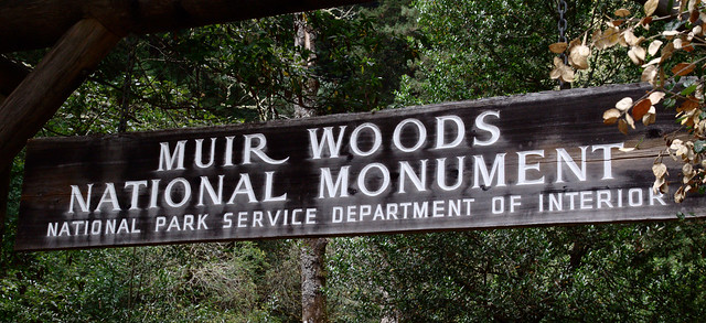 Sign at the entrance to Muir Woods
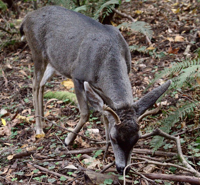
A very tame dwarf deer inside the park
What should have been a 50 minute drive turned into 40 minutes of pleasant, scenic driving followed by a couple hours of being utterly lost. We finally arrived in a parking spot around 1 PM. Fortunately, Lori had packed some leftover apple muffins from the night before so we were able to get some nourishment while we were lost. We spent the next 2 1/2 to 3 hours walking through the woods taking pictures and enjoying our hard-earned prize.
And now, lots of photos of trees!
 The lighting was a bit challenging because it was dark in the woods even though the sun was shining
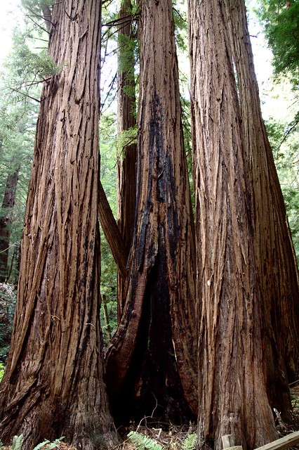
Some fire damaged trees. There were several throughout the park

Quite a few trees had fallen across the path, but only the sections blocking the trails had been removed.
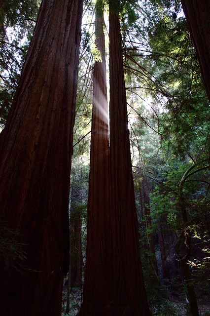
Rays of sunlight burst between two tall trees.
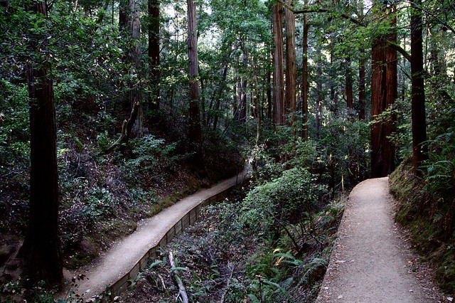
From the bend in Hillside Trail where it doubles back on itself. We had just walked along the right hand side and continued to the left.
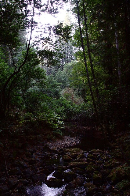
This photo really shows the contrast between the bright sky and the dark forest floor. A stream ran down the middle of the park with trails on either side and bridges crossing it at several points along the way.